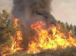
During recent decades, high income levels and low demographic growth have resulted in an increasing rate of land abandonment in rural areas of Spain. Many activities previously carried out in those lands, like forestry and farming, are not longer profitable, especially in Mediterranean areas. This land abandonment has resulted in an expansion of forest area and increase of the forest growing stock. This new situation has had important consequences in increasing the risk of forest fires as there is a clear relation between fire risk and the spatial arrangement and composition of forest fuels.
The inclusion of fire risk assessment into forest management and planning seems offers two clear opportunities. On one hand, enables the manager to analyse the risk and uncertainty as a result of forest fires, helping to assess the expected losses that those hazards may cause on the forest outputs, reducing the uncertainty involved in the decision-making process. On the other hand, forest management and planning offers an appropriate framework for identify efficient, and active measures for long term prevention. In this context, new scientific methods to assess the risk of fire at stand and landscape level, and tools to include the produced knowledge into forest planning systems must be provided in order to reach the goal of a manage our forest in a safest and profitable way.
The inclusion of fire risk assessment into forest management and planning seems offers two clear opportunities. On one hand, enables the manager to analyse the risk and uncertainty as a result of forest fires, helping to assess the expected losses that those hazards may cause on the forest outputs, reducing the uncertainty involved in the decision-making process. On the other hand, forest management and planning offers an appropriate framework for identify efficient, and active measures for long term prevention. In this context, new scientific methods to assess the risk of fire at stand and landscape level, and tools to include the produced knowledge into forest planning systems must be provided in order to reach the goal of a manage our forest in a safest and profitable way.
Related publications
González-Olabarria J.R., Mola-Yudego B., Coll L. (2015) Different factors for different causes: analysis of the spatial agrregation of fire ignitions in Catalonia (Spain). Risk analysis 35 (7):1197-209.
Herawati H, González-Olabarria JR., Wijaya A, Martius C, Purnomo H, Andriani R. (2015) Tools for assessing the impacts of climate variability and change on wildfire regimes in forests. Forests 6(5): 1476-1499
Valor, T., Gonzalez-Olabarria, J.R., Pique, M. (2015). Assessing the impact of prescribed burning on the growth of European pines. Forest Ecology and Management. 343: 101-109
Gonzalez-Olabarria, J.R., Rodrigez, F., Fernandez-Landa, A., Mola-Yudego, B. (2012) Mapping fire risk in the Model Forest of Urbión based on airborne LiDAR measurements. Forest Ecology and Management. 282: 149-156
Gonzalez-Olabarria. J.R., Brotons, L., Gritten, D., Tudela, A., Teres, J.A. (2012) Identifying location and causality of fire ignition hotspots in a Mediterranean region.International Journal of Wildland Fire. http://dx.doi.org/10.1071/WF11039
González-Olabarria, J.R., Mola, B. Pukkala, T, Palahí, M. (2011) Using multi-scale spatial analysis to assess fire ignition density in Catalonia, Spain. Annals of Forest Science. 68: 861-871.
Gonzalez-Olabarria, J.R. and Pukkala, T. (2011) Integrating fire risk considerations in landscape level forest planning. Forest Ecology and Management.261: 278-297.
